
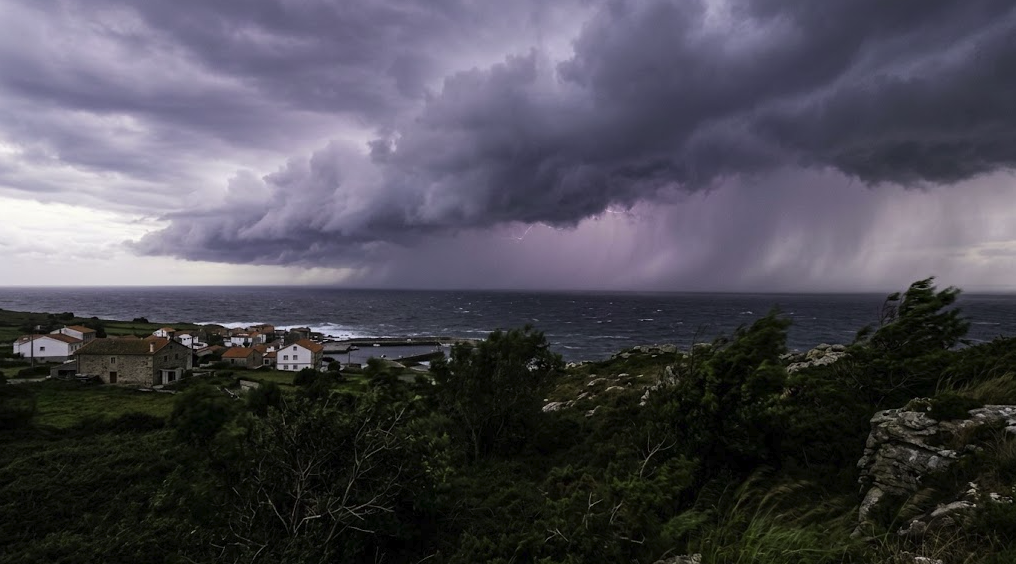

SPAIN – HIGRH NEWS: storm warning in Spain is in place as an Atlantic low-pressure system moves towards the Iberian Peninsula, bringing heavy rain, thunderstorms, hail and strong winds to several parts of the country, but which areas are expected to face the most unsettled conditions?

The weather situation is expected to become increasingly unstable as the Atlantic system approaches Spain.
The depression will bring humid air at lower levels of the atmosphere while colder air moves in higher up. This combination can create favourable conditions for the development of strong thunderstorms.

Western Andalusia, Catalonia, Valencia and parts of northeastern Spain are among the areas expected to experience the most unsettled weather.
Some storms could produce more than 20 millimetres of rain in a single hour, while parts of Aragon, Catalonia and northern Valencia could receive more than 60 millimetres over 12 hours.
Strong wind gusts and hail are also possible, with some gusts potentially reaching 70 to 80 kilometres per hour.
Storm warning in Spain as an Atlantic depression approaches
The change in weather is linked to a low-pressure system developing to the west of the Iberian Peninsula.
The system is expected to increase atmospheric instability as warm, humid air remains close to the surface while colder air moves through higher levels.
That contrast can encourage the rapid development of thunderstorms.
The State Meteorological Agency, AEMET, provides official warnings for adverse weather conditions across Spain and updates them as the situation develops.
The weather pattern is particularly notable because of the timing of the disturbance during August.
The combination of Atlantic air and moisture from the Mediterranean could create different types of severe weather across the country.
Not every area will experience the same conditions.
Some regions could see persistent rain, while others may experience short but intense thunderstorms accompanied by hail and sudden wind gusts.
The exact location of the strongest storms will depend on how the depression develops and moves across the peninsula.
Rain will move eastwards from the north-west
The first effects of the Atlantic system are expected in the western and northern parts of Spain.
Galicia and Asturias could be among the first regions to see increasing rainfall as the disturbance moves inland.
The unsettled conditions are then expected to spread towards Castilla y León, Extremadura and western Andalusia.
Rainfall could become persistent in parts of the north-west, while strong winds may develop in exposed areas.
Mountainous areas could also experience stronger gusts as the system moves across the country.
The weather will not remain limited to the western half of Spain.
As the system progresses, instability could become more significant across the central and eastern parts of the country.
Catalonia, Aragon and northern Valencia are among the areas where thunderstorms could become particularly intense.
The Mediterranean may provide additional moisture, helping some storm cells to strengthen as they move across eastern Spain.
Storm warning in Spain includes risk of intense rainfall and hail
One of the main concerns associated with the weather system is the intensity of the rainfall.
Some thunderstorms could produce more than 20 millimetres of rain in just one hour.
When significant rainfall falls over such a short period, water can accumulate rapidly on roads, in low-lying areas and around small waterways.
Parts of Aragon, Catalonia and northern Valencia could also record more than 60 millimetres of rain over a 12-hour period.
The amount of rainfall will not necessarily be evenly distributed.
Thunderstorms can produce very different totals over relatively short distances, meaning one location could experience intense rainfall while a nearby area receives considerably less.
Hail is another possible hazard.
The strongest thunderstorms could produce hail alongside torrential rain and sudden wind gusts.
The combination could create difficult conditions for road users and outdoor activities.
For that reason, the development of official weather warnings will remain important as the system moves across Spain.
Strong winds could accompany the thunderstorms
Rain and thunderstorms will not be the only concerns.
Forecasts indicate that wind gusts could reach between 70 and 80 kilometres per hour in some areas.
Western Castilla y León is among the areas where the strongest gusts are possible.
Strong winds are also expected across Galicia, the central plateau and mountainous parts of northern Spain.
Wind conditions can change quickly when thunderstorms pass through.
A storm cell can produce sudden gusts and abrupt changes in wind direction over a relatively small area.
These conditions can make driving more difficult, particularly when strong wind occurs at the same time as heavy rain or hail.
Outdoor objects and lightweight structures can also be affected by stronger gusts.
The intensity of the wind will vary depending on the location and development of individual storm cells.
Western Andalusia could also see unsettled weather
Western Andalusia is among the regions expected to experience the changing conditions as the Atlantic system moves across Spain.
Rain and thunderstorms could develop after the initial arrival of the disturbance in the north-west.
The amount and intensity of rainfall will vary between locations.
Some areas may experience brief heavy showers, while others could see more organised thunderstorms.
The combination of humid air and atmospheric instability means that storms could develop quickly.
Strong wind gusts may accompany the most active cells.
The situation will therefore depend heavily on the exact position and movement of the low-pressure system.
Residents and travellers in affected areas should follow the latest official weather information as conditions evolve.
AEMET’s warning service provides updated information on potentially adverse weather across Spain.
Official source AEMET – Meteorological Warnings
Catalonia, Aragon and Valencia face greater instability
The eastern part of Spain could experience some of the most active thunderstorms during the episode.
Catalonia, Aragon and northern Valencia are among the areas highlighted for potentially intense storms.
The Mediterranean plays an important role because warm, humid air close to the surface can provide additional moisture for developing storm systems.
When this moisture meets colder air higher in the atmosphere, conditions can become highly unstable.
Some thunderstorms could therefore intensify rapidly.
Heavy rain, hail and strong wind gusts may occur within the strongest cells.
The possibility of rainfall exceeding 60 millimetres over 12 hours is particularly relevant for parts of Aragon, Catalonia and northern Valencia.
However, the distribution of rainfall is expected to remain uneven.
Not every town or city within these regions will necessarily experience the same weather.
The strongest effects will depend on where the most developed thunderstorms form and how long they remain active.
Flash flooding remains a potential risk
Heavy rainfall concentrated over a short period can cause rapid rises in small rivers, streams and ravines.
This makes sudden flooding one of the potential risks associated with the storm system.
A thunderstorm can release a large volume of water over a relatively small area, causing water levels to rise quickly.
Low-lying locations and areas close to waterways can be particularly vulnerable when intense rainfall develops.
Roads can also become difficult to use when water accumulates quickly.
Reduced visibility, standing water, hail and strong winds can create challenging driving conditions.
The situation may change rapidly as individual thunderstorms develop and move.
Some cells may weaken quickly, while others could remain active for several hours.
Following updated weather warnings can help identify which areas face the greatest risk at any given time.
Conditions should gradually improve later in the day
The unsettled weather is not expected to remain at the same intensity throughout the entire day.
Conditions should gradually become more stable towards the end of the day as the low-pressure system weakens.
However, this does not mean that all instability will disappear immediately.
Some thunderstorms could remain active even after the main part of the depression has moved away.
The timing of the improvement will vary between regions.
The western areas are expected to experience the initial effects, with the disturbance then progressing towards central and eastern parts of Spain.
Mediterranean moisture could continue to support thunderstorms in the east even as the main Atlantic system weakens.
The weather should therefore be viewed as a gradual transition rather than a single moment of deterioration.
The most severe conditions will occur where the atmospheric ingredients come together to support stronger storm development.
More Atlantic disturbances could arrive later in August
The approaching system may not be the final weather disturbance to affect Spain during the second half of August.
Further Atlantic systems could reach the country during the final days of the month.
The exact evolution will depend on atmospheric conditions over the Atlantic and the eventual path followed by subsequent low-pressure systems.
For now, the expected pattern is being driven by the contrast between warm, humid air at lower levels and colder air higher in the atmosphere.
That combination is favourable for thunderstorms and explains the possibility of heavy rainfall, hail and strong winds.
The episode also highlights the importance of checking official weather information before travelling through areas affected by severe weather.
Thunderstorms can develop quickly and conditions can vary significantly between nearby locations.
What to expect across Spain
The weather change is expected to begin in the west and north-west, with Galicia and Asturias among the first areas likely to see increased rainfall.
The unsettled conditions will then move towards Castilla y León, Extremadura and western Andalusia.
In eastern and north-eastern Spain, conditions could become particularly unstable, with Catalonia, Aragon and northern Valencia among the areas facing a greater risk of intense thunderstorms.
Some locations could receive more than 20 millimetres of rain in one hour.
Parts of Aragon, Catalonia and northern Valencia could exceed 60 millimetres over 12 hours.
Hail and wind gusts of up to 70 or 80 kilometres per hour are also possible.
Conditions should gradually improve later in the day as the depression weakens, although isolated thunderstorms may continue.
The overall weather pattern will therefore be characterised by heavy rain, thunderstorms, hail and strong winds across different parts of Spain.
For the latest official warnings and updates, AEMET remains the national reference for adverse weather information.
Frequently Asked Questions about the storm warning in Spain
Which areas could see the strongest storms?
Aragon, Catalonia and northern Valencia are among the areas facing a greater risk, although other parts of Spain could also experience severe weather.
How much rain could fall?
Some locations could receive more than 20 millimetres in one hour, while parts of the east could exceed 60 millimetres over 12 hours.
Will there be strong winds?
Yes. Gusts could reach around 70 to 80 kilometres per hour in some areas.
When should conditions improve?
The weather is expected to become more settled later in the day as the Atlantic depression weakens…….MORE